Showing posts with label Pennsylvania. Show all posts

Monday, March 31, 2008

Milesburn Cabin Loop Hike - 3.9 miles


PENNSYLVANIA, CUMBERLAND COUNTY, MICHAUX FOREST

This Loop goes on the Appalachian Trail, down a snowmobile trail, and onto Milesburn Road. It passes the Milesburn Cabin which you can rent from the Potomac Appalachian Trail Club. Milesburn Road doesn’t get plowed when it snows so it gets slippery. I fell on my butt at least once the first time I took this Loop in January. My favorite part of this loop is the snowmobile trail; however there are numerous unmarked roads off this trail. Sometimes it is difficult to figure out which one you should take. A dirt road at [N39 59.207 W77 26.236] heads left, southwest, to a Wild Turkey Habitat [N39 58.969 W77 26.513] maintained by the Pennsylvania Bureau of Forestry.

PARKING
-From Shippensburg, take Queen Street, which turns into Baltimore Road, which turns into Shippensburg Road when you get to the Big Flat Area.
-Take Ridge Road (dirt road) southwest
-In approximately 2 miles you will see a parking area on the right and a gated access trail to the Appalachian Trail and the Rocky Knob Trail on the left.
-GPS Coordinates for Parking [N39 58.678 W77 26.486]

TRAIL
-Cross the road, southeast from the parking area, to the gated trail. Follow orange blazes up hill.
-Take a left, northeast, [N39 58.630 W77 26.332] onto the Appalachian Trail, which has white blazes.
-Follow the AT till you come to the power line dirt road [N39 58.977 W77 25.772]. Take the power line road up hill, northwest, to Ridge Road.
-Cross Ridge Road, through the gates and go down the hill, northwest. This dirt road is also a marked snowmobile Trail. This road has been moved several times, and has numerous dirt off shoots, so it is occasionally difficult to follow.
-At [N39 59.254 W77 26.258] the dirt road splits. Go to the left, west.
-You will eventually come to the bottom of the hill, at a gate to Milesburn Road [N39 59.133 W77 26.733].
-Go left, southwest, on Milesburn Road to Milesburn Cabin [N39 58.655 W77 27.160]. The Milesburn Cabin is about .7 mile from the gate.
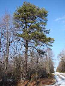
-Take the AT [white blazes] up the hill, southeast. At the top of the hill the AT will cross Ridge Road. Stay on the Appalachian Trail. The AT goes through a pine forest. You will eventually cross the Rocky Knob Trail.
-At the Rocky Knob Trail [N39 58.630 W77 26.332] turn left, northwest, down the hill to parking.


For more information and a map.....

TURKEY TRAIL LOOP HIKE - 2.3 miles


PENNSYLVANIA, CUMBERLAND COUNTY, MICHAUX FOREST

I ran across a Turkey Habitat one day when I was meandering down Ridge Road. The Pennsylvania Bureau of Forestry is trying to bring back wild turkeys to Michaux Forest. While looking around the Habitat, I found an old road heading down the hill and wondered if it went to the Birch Run Shelter on the Appalachian Trail. Actually the road dead ends 2/3 of the way down the hill and I had to bushwhack the rest of the way. This bushwhack is the roughest parts of this Loop. This old road is pretty overgrown and when it ends you need to walk through the huckleberry brambles. I used a compass and a GPS to make it through the brambles to Birch Run Shelter. The rest of the Loop is on the Appalachian Trail and dirt roads. Ridge Road doesn’t get plowed when it snows, so it can be a slippery walk from the Parking area under the power line.


PARKING
-From Shippensburg, take Queen Street, which turns into Baltimore Road, which turns into Shippensburg Road when you get to the Big Flat Area.
-Take Ridge Road (dirt road) southwest
-In approximately 1.4 miles you will see a parking area on the right, underneath the power line.
-GPS Coordinates for Parking [N39 59.057 W77 25.921]


TRAIL
-Walk back up Ridge Road, northeast, for .7 mile, to a gated dirt road on the right which heads to the Turkey Habitat. [N39 59.539 W77 25.371]
-Go southeast through the gate to the Wild Turkey Habitat. [N39 59.517 W77 25.310]
-Go southeast across the Habitat to an overgrown road which goes down over the hill. Brambles are about knee high. This road gets harder to follow the further it goes down the hill. Point your GPS unit toward Birch Run Shelter. Heading down the hill will eventually bring you out on the Appalachian Trail.
-You should come out onto the Appalachian Trail somewhere near the Birch Run Shelter. [N39 59.122 W77 25.173]
-Head west on the Appalachian Trail. [If you see the AT signs at the Shelter you will be heading south toward Caledonia, Route 30, and Quarry Gap Shelter.]
-When you head past the Shelter you will be heading up the hill. Keep going until you get to the top of the hill and to the power line dirt road [N39 58.989 W77 25.767]
-Turn right, northwest, up the hill on the power line dirt road back to the parking area on Ridge Road.


For more information and a map.....

Wednesday, March 19, 2008

Big Flat Ridge Loop Hike - 2.4 miles


PENNSYLVANIA, CUMBERLAND COUNTY, MICHAUX FOREST

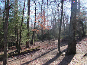
This loop hike uses an unmarked trail to connect the Rocky Knob Trail with Fegley Road (a dirt road) and then the Appalachian Trail. The unmarked trail section of this hike is most interesting as it winds all over the place. It crosses a small creek and goes through some interesting hardwood areas. I also found this trail almost impossible to follow after it snowed one cold winter day because there are no blazes.

PARKING
-From Shippensburg, take Queen Street, which turns into Baltimore Road, which turns into Shippensburg Road when you get to the Big Flat Area.
-Take Ridge Road (dirt road) southwest
-In approximately 2 miles you will see a parking area on the right and a gated access trail to the Appalachian Trail and the Rocky Knob Trail on the left.
-GPS Coordinates for Parking [N39 58.678 W77 26.486]

TRAIL
-Cross the road, southeast from the parking area, to the gated trail.
-Follow the orange blazes across the Appalachian Trail onto the Rocky Knob Hiking Trail.
-At [N39 58.514 W77 26.149] an unmarked trail goes off to the left, east. Look carefully as you may miss this. If you see another sign for Rocky Knob which goes east, you have gone too far.
-Follow the unmarked trail as it winds through the forest. It dead ends at Fegley Road (dirt) [N39 58.650 W77 25.699].
-Follow Fegley Road left, uphill, north.
-Cross under the power lines. Stay to the right on dirt road, northeast.
-At the top of the hill the Appalachian Trail crosses the dirt road [N39 58.977 W77 25.772]. Take the AT left, southwest and follow the white blazes.
-When the AT crosses the Rocky Knob Trail [N39 58.633 W77 26.320] take it to the right, northwest back to parking.


For more information and a map.....