PENNSYLVANIA, CUMBERLAND COUNTY, MICHAUX FOREST
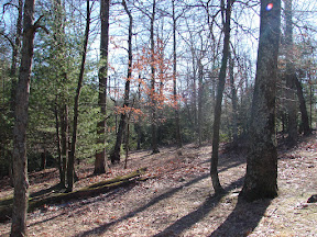
I ran across a Turkey Habitat one day when I was meandering down Ridge Road. The Pennsylvania Bureau of Forestry is trying to bring back wild turkeys to Michaux Forest. While looking around the Habitat, I found an old road heading down the hill and wondered if it went to the Birch Run Shelter on the Appalachian Trail. Actually the road dead ends 2/3 of the way down the hill and I had to bushwhack the rest of the way. This bushwhack is the roughest parts of this Loop. This old road is pretty overgrown and when it ends you need to walk through the huckleberry brambles. I used a compass and a GPS to make it through the brambles to Birch Run Shelter. The rest of the Loop is on the Appalachian Trail and dirt roads. Ridge Road doesn’t get plowed when it snows, so it can be a slippery walk from the Parking area under the power line.
PARKING
-From Shippensburg, take Queen Street, which turns into Baltimore Road, which turns into Shippensburg Road when you get to the Big Flat Area.
-Take Ridge Road (dirt road) southwest
-In approximately 1.4 miles you will see a parking area on the right, underneath the power line.
-GPS Coordinates for Parking [N39 59.057 W77 25.921]
TRAIL
-Walk back up Ridge Road, northeast, for .7 mile, to a gated dirt road on the right which heads to the Turkey Habitat. [N39 59.539 W77 25.371]
-Go southeast through the gate to the Wild Turkey Habitat. [N39 59.517 W77 25.310]
-Go southeast across the Habitat to an overgrown road which goes down over the hill. Brambles are about knee high. This road gets harder to follow the further it goes down the hill. Point your GPS unit toward Birch Run Shelter. Heading down the hill will eventually bring you out on the Appalachian Trail.
-You should come out onto the Appalachian Trail somewhere near the Birch Run Shelter. [N39 59.122 W77 25.173]
-Head west on the Appalachian Trail. [If you see the AT signs at the Shelter you will be heading south toward Caledonia, Route 30, and Quarry Gap Shelter.]
-When you head past the Shelter you will be heading up the hill. Keep going until you get to the top of the hill and to the power line dirt road [N39 58.989 W77 25.767]
-Turn right, northwest, up the hill on the power line dirt road back to the parking area on Ridge Road.
For more information and a map.....
No comments:
Post a Comment