PENNSYLVANIA, CUMBERLAND COUNTY, MICHAUX FOREST
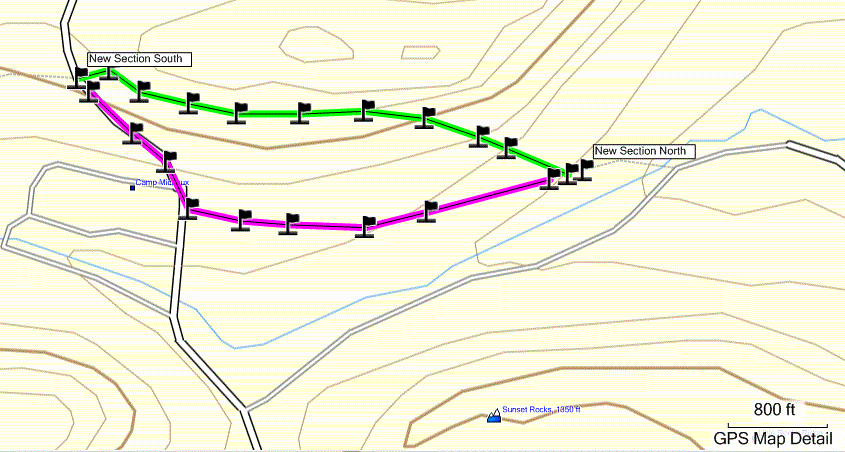
This Loop goes on the Appalachian Trail, down a snowmobile trail, and onto Milesburn Road. It passes the Milesburn Cabin which you can rent from the Potomac Appalachian Trail Club. Milesburn Road doesn’t get plowed when it snows so it gets slippery. I fell on my butt at least once the first time I took this Loop in January. My favorite part of this loop is the snowmobile trail; however there are numerous unmarked roads off this trail. Sometimes it is difficult to figure out which one you should take. A dirt road at [N39 59.207 W77 26.236] heads left, southwest, to a Wild Turkey Habitat [N39 58.969 W77 26.513] maintained by the Pennsylvania Bureau of Forestry.
PARKING
-From Shippensburg, take Queen Street, which turns into Baltimore Road, which turns into Shippensburg Road when you get to the Big Flat Area.
-Take Ridge Road (dirt road) southwest
-In approximately 2 miles you will see a parking area on the right and a gated access trail to the Appalachian Trail and the Rocky Knob Trail on the left.
-GPS Coordinates for Parking [N39 58.678 W77 26.486]
TRAIL
-Cross the road, southeast from the parking area, to the gated trail. Follow orange blazes up hill.
-Take a left, northeast, [N39 58.630 W77 26.332] onto the Appalachian Trail, which has white blazes.
-Follow the AT till you come to the power line dirt road [N39 58.977 W77 25.772]. Take the power line road up hill, northwest, to Ridge Road.
-Cross Ridge Road, through the gates and go down the hill, northwest. This dirt road is also a marked snowmobile Trail. This road has been moved several times, and has numerous dirt off shoots, so it is occasionally difficult to follow.
-At [N39 59.254 W77 26.258] the dirt road splits. Go to the left, west.
-You will eventually come to the bottom of the hill, at a gate to Milesburn Road [N39 59.133 W77 26.733].
-Go left, southwest, on Milesburn Road to Milesburn Cabin [N39 58.655 W77 27.160]. The Milesburn Cabin is about .7 mile from the gate.
-Take the AT [white blazes] up the hill, southeast. At the top of the hill the AT will cross Ridge Road. Stay on the Appalachian Trail. The AT goes through a pine forest. You will eventually cross the Rocky Knob Trail.
-At the Rocky Knob Trail [N39 58.630 W77 26.332] turn left, northwest, down the hill to parking.
For more information and a map.....


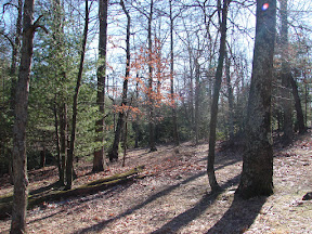
 I finally did something I have wanted to do for a long time. I followed Tom's Run from where it crosses the AT (near the shelter) east to Camp Michaux. The snow melt caused the creek to flow deeply enough that it had overflowed the banks and scoured the debris away from the banks. Most of the plants that would make a bushwhack difficult later in the summer were just showing their green noses out of the leaves. The first half of the way was fairly easy. The closer to the remains of Camp Michaux I got the more pine trees and brambles I needed to push through. Of course I took pictures of the Run the whole way.
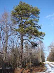
 I took a hike this morning past Tom's Run Shelter. I bushwhacked from the Appalachian Trail where Tom's Run crosses the Trail near the Shelter. Because of the rain last week and the snow melt the Run was higher than it usually is at this time of year. The sky was a brilliant blue and it was cold - 18 degrees. Most of the pictures I took this morning were of puddles with ice forming on them. I particularly like these two photos because of the pools and the waterfalls and the ice.
  I actually met a bunch of cold-looking hikers who had slept on the Trail last night. They looked pretty happy though. You can't beat walking in Michaux.
 Monday, January 18, 2010, was the last free day I had before the semester started again at Shippensburg University. It just happened to be a lovely [but cold] day. A good day for a walk on the Appalachian Trail [or part of it anyway] The snow we had at Xmas was slowly melting.